")
Hey, we are the Kayak and Canoe Club of New York…and what could be more about Kayaking and New York then kayaking around New York (County), more popularly known as Manhattan Island.
 It’s a 30+ mile paddle but since done right you’re floating with the tides it’s surprisingly easy…if you think spending 8 hours sitting in a kayak is easy.
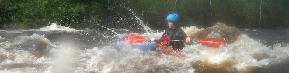
That being said, this is not a paddle for the inexperienced.
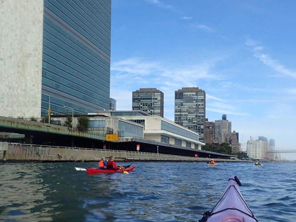
Lower Manhattan from the Ferry terminals at 38th street to South Street Seaport but especially around the tip after North Cove….is just crazy…competing currents, tons of boat traffic, waves coming in off the ocean and bouncing back of the seawalls, no place to get out.
But it’s not class 5 rapids (or even class 3 or 2) either and competent sea or whitewater paddlers should easily be able to do it…
Lower Manhattan is really busy and timing your way around the tip is important.
Get some experienced urban paddlers to show you the ropes.
In the busy areas – south cove to the Brooklyn Bridge, keep the group tightly together as you will be both more visible and easier to avoid. This means paddling at the rate of the slowest paddlers.
Ferries
1 rope you need to know is ferries move really fast. Most have bow thrusters which allow them to turn amazingly fast (especially empty) and are on tight schedules.
Check the Staten Island Ferry Schedule and don’t get anywhere near these huge boats. Waiting to cross just after they arrive or leave is a good idea.
Marine Radios are a good idea as they are how you communicate with boats.
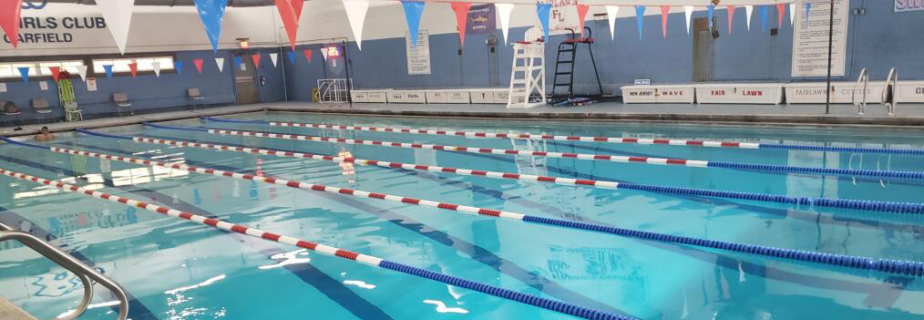
On most of this trip you can’t get out of the water as high bulkheads separate you from the shore. So the group needs the skills for self rescue (and plan your bathroom schedule;-)
You have to follow the currents around the Island, so timing is critical.
How to Paddle Around Manhattan from Englewood
Start at the Englewood Boat Basin (Exit 1 off the Palisades Interstate Parkway in NJ), leaving about 1 to 1.5 hours after low water at New York (The Battery).
Pro tips: Launch from the end of the small stream at the south end of the boat basin. Landing at higher tide you can just paddle up the stream. In season you don’t want to pay go north to Undercliff Picnic Area, but this is a muddy launch at low tide. Drop your boats at the beach by the road at the very bottom of the hill, park at the picnic area parking and carry your stuff down.
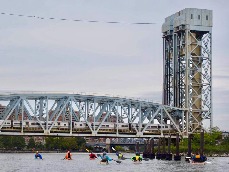
Go counterclockwise around Manhattan, heading south down the Hudson. You should reach the southern tip of Manhattan Island in about 2.5 to 3 hours, then start heading north up the East River. Note caveats above about getting around lower Manhattan safely. There is a small beach just right underneath the Manhattan side of the Brooklyn Bridge where you can take a rest stop, but don’t stay long because you’ll want to catch the raging northward current in the East River.

Beach under Spuyten Duyvel waiting for tide to change, needed if you parked south of Englewood.
You should reach Mill Rock (the little island in the middle of the river, directly across from 96th St. in Manhattan ) in about 1.5 to 2 hours. There is a little cove on the north side of Mill Rock where you can beach your boat, or you can paddle a little further up river to Randall’s Island/Ward’s Island and beach there. Wait for about 1to 1.5 hours, then begin north up the Harlem River about 8 hours after low water at the Battery. You will reach Spuyten Duyvel (the confluence with the Hudson River) in about 2 hours. Paddle directly west across the Hudson to the Boat Basin. Total trip time is about 9 hours.
Spuyten Duyvel tide 40 min behind battery
Paddling around Manhattan From Liberty State Park
You have to follow the shifting currents around the Island, so timing is critical.
Start at the Liberty State Park boat launch (Exit 14B off the NJ Turnpike Extension), leaving about 4 hours after low water at New York (The Battery). Go counterclockwise around the Island, heading east across the Harbor and north up the East River. You will reach Mill Rock (the little island in the middle of the river, directly across from 96th St. in Manhattan ) in about 2 to 2.5 hours. There is a little cove on the north side of Mill Rock where you can beach your boat, or you can paddle a little farther north and beach on Randall’s Island. Wait for about 1 or 1.5 hours, then begin north up the Harlem River about 7.5 hours after low water at the Battery. You will reach Spuyten Duyvel (the confluence with the Hudson River) in about 2 hours. There is a little beach on the south side of Spuyten Duyvel, in between the high, arching Henry Hudson Bridge and the low, swivel railroad bridge at the entrance to the Hudson. Wait there for about one-half to 1 hour, then begin south down the Hudson. Depending on the wind, you will reach Liberty State Park in about 3-4 hours. Try to avoid days with strong south winds. Total trip time is 9 – 10 hours.
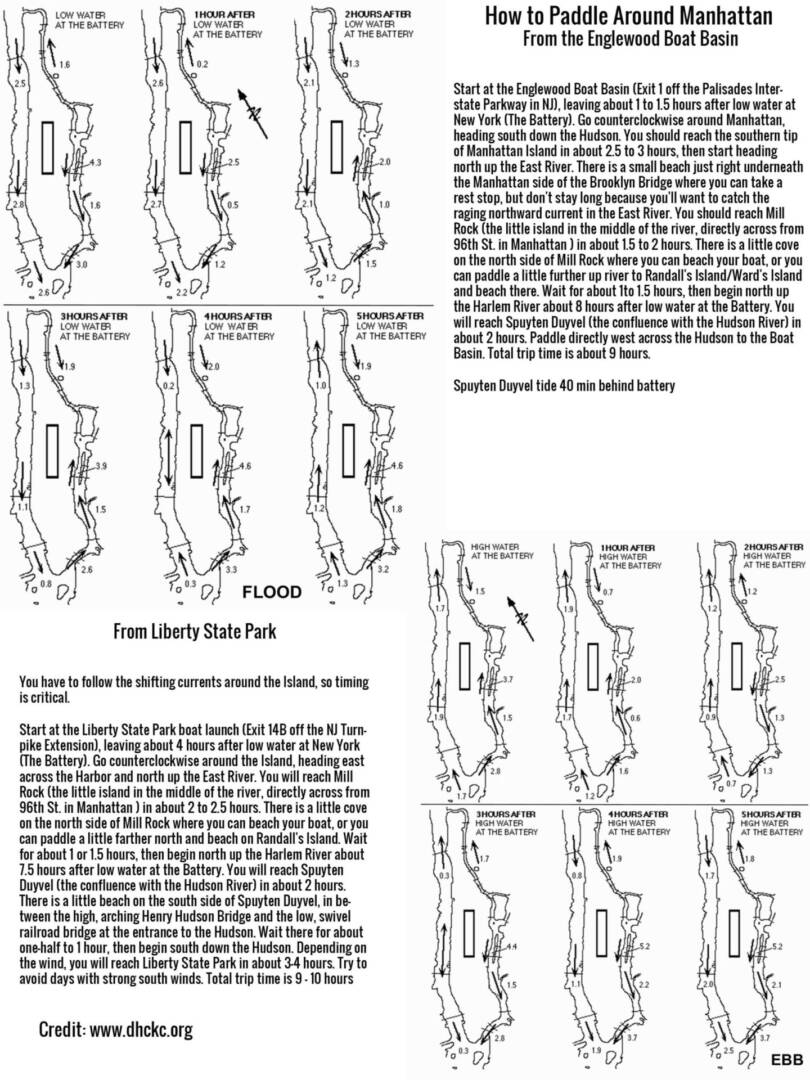
How to Paddle Around Manhattan From the Englewood Boat Basin and Liberty SP – printable cheat sheet