

Most recent camera gauge picture above. Older pictures below to see change


Flows:
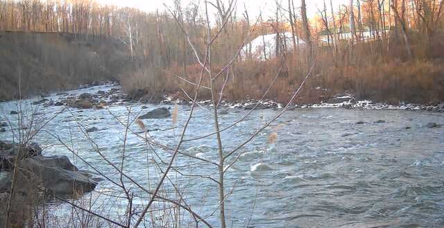
Low runnable -most start at 32 at this level
Low Flow shown at right.
Normally only the gorge (32 to Forge Hill Road) is run at low flow and below as above 32 is boring with no play and some very scrapy sections and below forge hill several rapids including Pack-man won’t go at all, possibly leaving you stuck in an awkward spot.
Very high flow. Barely touch on 1st dam, can’t stay below 2nd, sticky holes but many rapids washing out.
Higher flow – when you can’t see the ledge on the center pillar.
Stout, getting into class 4: Holes are getting pretty substantial though more sneak routes open up. Running first dam isn’t outright boat abuse. Pillars (portagable, 3ish sneak) and factory (long portage) are getting into class 4.
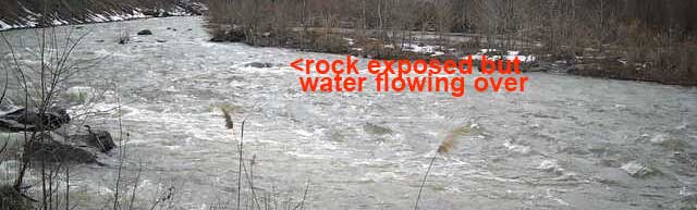
ELF (Extra Low Flow): How much to you like your boat? Rapid shown by camera is typical of scrapier sections though not the worst spot. You should be able to stay in your boat if it looks like you could get down the rapid shown.
Pillars holds wood so run cautiously or scout. Skilled paddlers who know the river can boat scout, bumping down the right side and hitting the eddies on the right of this picture above the far right pillars. If unfamiliar with the river or uncertain of your skills, scout river right pulling out at the top above the island. (Of course that goes for any drop on any river…if you can’t see what’s at the bottom, don’t leave the eddy).
From the eddy above the far right pillar, the main line is ferrying to left of the central ‘wave’ pillar, with a sneak dropping sneaking off the furthest point of the shelf to the right of the central ‘wave’ pillar.
From above this sneak looks like a vertical drop into a retentive hole, but is a sloping slide.
Hazards:
Horizontal log in center of Rootball, the final rapid where the channel splits after turning below an eroding bank. At higher levels could be bad as it would be at or just below waterline. Visible and avoidable at lower and normal levels but could be a real problem at high levels….go right to avoid.
Moodna Meeting locations
River Classification *III (IV at very high water)
Description * This River is listed on the American Whitewater site at https://www.americanwhitewater.org/content/River/view/river-detail/1350/main. Mostly class III section begins at the Rt. 94 bridge. and ends at the pack-man rapid along Forge Hill Road. At higher levels the 2 hardest rapids get into class 4. Dragon’s tooth has significant maneuvering in bigger water. Factory below the second dam is more straightforward but a bad place to be upside down as it ends in a high speed chute.
For the class 2 section above and below the harder part, 32 parallels the upper section and Forge Hill Road parallels the lower section, both on river right.
Tidewater below 9 with a pretty estuary. Closest accessible takeout if you head down river is Sloop Hill State Unique Area. Most folks will not want to do this in a whitewater boat.